Full paper due:
September 25, 2023
Author notification:
October 3, 2023
Camera-Ready deadline:
October 12, 2023
Yan Huang
Jean-Claude Thill
Hui Zhang
Danhuai Guo
Yi Liu
Wei Xu
Bin Chen
WYA: A Novel Spatial Scene Classification Framework Based on Surrounding Object Detection
Ruoling Wu and Danhuai Guo
Enhancing Collaborative Emergency Management: Leveraging Blockchain Distributed Ledger for Inter-Agency Data Sharing
Qi Wang and Yi Liu
The ACM SIGSPATIAL International Conference on Advances in Geographic Information Systems 2023 (ACM SIGSPATIAL 2023), the thirty-first edition, will be held in Hamburg, Germany, November 13-16, 2023. Traditionally, all workshops will be held on November 13, 2023 at the main conference venue. The former workshops, known as EM-GIS, had been held several times, starting in 2015 and continuing until 2021. EM-GIS 2023 aims to continue this practice and invites submission of papers.
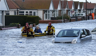
Safety refers to the stable external environment and orders wherein society and citizens need to engage in and conduct normal life, work, study, entertainment, and communication. Resilience in public safety refers to the ability to withstand the shocks and pressures of emergencies on society, economy, technology systems and infrastructure, and to maintain the basic structure and functions of an emergency event. The Resilience theory is dedicated to enhancing disaster resistance and recovery capabilities as well as improving emergency response capabilities. So that systems, communities, or societies exposed to hazards can resist and absorb them by protecting and restoring important basic structures and functions effectively in time.
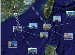
Emergency management serves as an important aspect of Safety and resilience, involving four stages: Planning and Mitigation, Preparedness, Response and Recovery. Geospatial applications (including GIS) have been extensively used in each stage of emergency management. Decision-makers can utilize the geospatial information to develop planning and mitigation strategies. GIS models and simulation capabilities are used to exercise response and recovery plans during non-disaster times. They help the decision-makers understand near real-time possibilities during an event. Once a disaster occurs, GIS will take effect in real-time response and recovery activities. For example, while global communities are trying to respond to the COVID-19 pandemic, GIS tools are widely used by health departments, safety and emergency management authorities and wider professionals around the world for gathering and analyzing data to support informed decisions, greatly enhancing safety and resilience in an anthropogenic incident or a natural disaster.
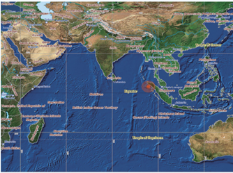
GIS provides reliable support for spatial analysis and decision-making in safety and resilience. However, the incorporation of spatial dimension or spatio-temporal dimension adds to the difficulties of the analysis. How to integrate data and models with spatial structures, such as integrating the GIS data layers and dangerous chemical diffusion data, appears as a big issue faced by safety and resilience work. Furthermore, safety and resilience require abilities to make quick responses to real-time situations. To meet the requirement, it is challenging and promising to apply lots of new geospatial technologies to support the quick response and recovery and the integration of location-based wireless information streams. With the advances in GIS technologies, the improvement of safety and resilience research becomes possible.
The purpose is to provide a forum for researchers and practitioners to exchange ideas and progress in related areas and bring together researchers and practitioners in massive spatio-temporal data management, spatial database, spatial data analysis, spatial data visualization, data integration, model integration, cloud computing, parallel algorithms, internet of things, complex event detection, optimization theory, intelligent transportation systems and social networks to support better public policy through disaster detection, response and rescue.
We invite two types of submissions in the workshop:
• Long Paper: presenting completed work including a complete description of methods, results and validation (4,000-6,000 words references included, 6 pages at most).
• Short Paper: presenting work in earlier stages, outlining and discussing concepts and methods and presenting first results (2,000-3,500 words references included, 4 pages at most).
Manuscripts should be submitted in PDF format according to the ACM camera-ready templates available at http://www.acm.org/publications/proceedings-template.
Papers must be electronically submitted at the following address: https://easychair.org/conferences/?conf=emgis2023.
Every paper will be reviewed by at least 3 PC members, and the papers will be selected according to review results. For each accepted paper, at least one of the authors should register and participate in the workshop in order to have the paper included in the workshop proceedings. The selected papers will be recommended to the SI of Journal of Safety Science and Resilience (https://www.sciencedirect.com/journal/journal-of-safety-science-and-resilience).
We make the final workshop schedule after communication with the ACM SIGSPATIAL 2023 main conference committee. This is the suggested schedule:
Full paper due: September 25, 2023
Author notification: October 3, 2023
Camera-Ready deadline: October 12, 2023
EM-GIS 2021: https://em-gis.github.io/EMGIS2021/
EM-GIS 2020: https://em-gis2020.github.io/CallForPaper/
EM-GIS 2019: https://em-gis2019.github.io/CallForPaper/
EM-GIS 2018: https://em-gis2018.github.io/CallForPaper/
EM-GIS 2017: https://em-gis2017.github.io/
EM-GIS 2023